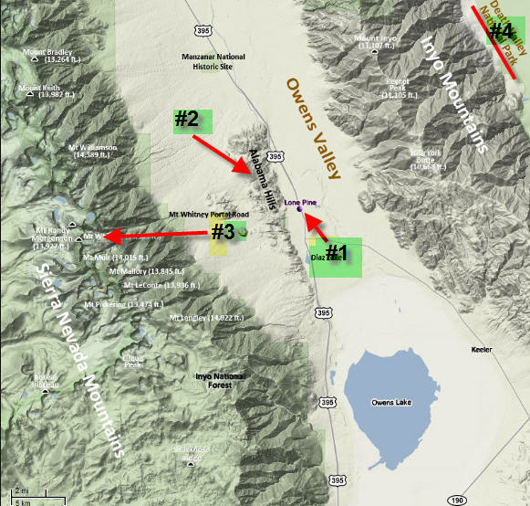
The Alabama Hills - Part 1There are two ways to go to Death Valley from Los Angeles. The most popular is to drive towards Las Vegas. About two thirds of the way there, turn north to Death Valley. The other alternative is to head North from Los Angeles through the Mojave Desert to a little town on the Eastern Sierras called Lone Pine where you turn East to go to Death Valley. On this trip, we went to Lone Pine and spent an evening and morning photographing one of the coolest but seemingly unknown parts of the Eastern Sierras called the Alabama Hills. In the map below, The number one arrow is pointing to the town of Lone Pine; number two points the area called the Alabama Hills directly West of Lone Pine; and arrow number three points to Mt Whitney, the tallest mountain in the Continental United States. Our destination, Death Valley, is item number four.
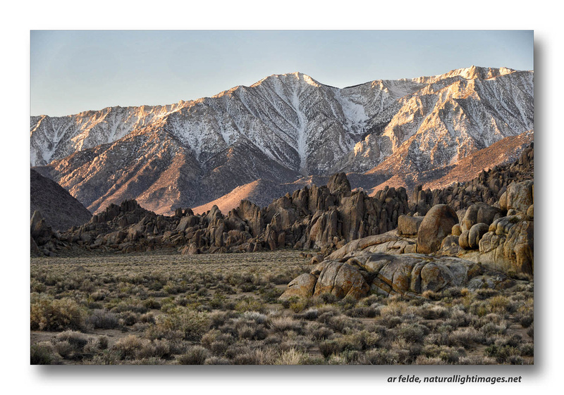
As you can see, the Alabama Hills are small range of hills and rock formations at the very edge of the Sierras. They are extremely picturesque and have been the location for 400 plus movies and TV programs! If you have watched a John Wayne movie; a Lone Ranger episode (my favorite as a child ... but on the radio ... no TV!) or any of countless other westerns, then you've no doubt seen a part of the Alabama Hills! Here's a view of a tiny, tiny portion of the Alabama Hills dwarfed by the 14,000 foot Sierras in the background:
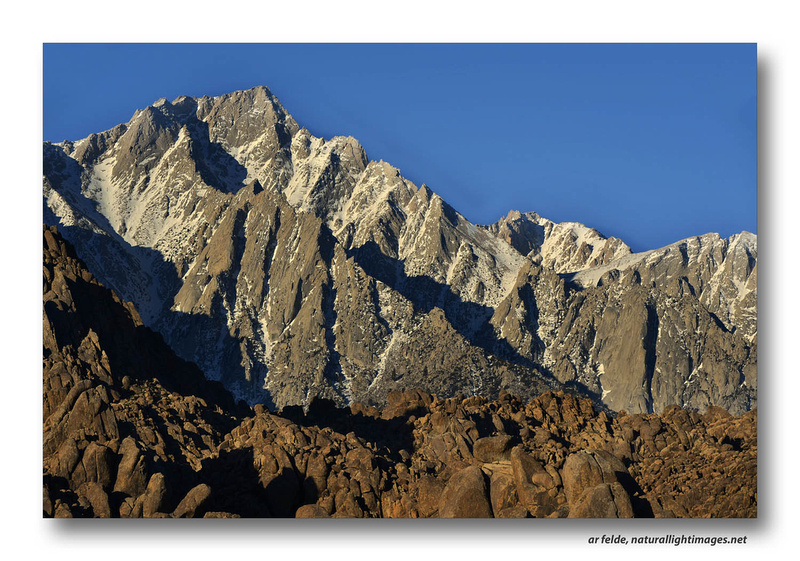
and this next view was taken from the same spot, but turned 90 degrees to the right. The brown rocks of the Alabama Hills are in the foreground and Mt. Whitney in the background:
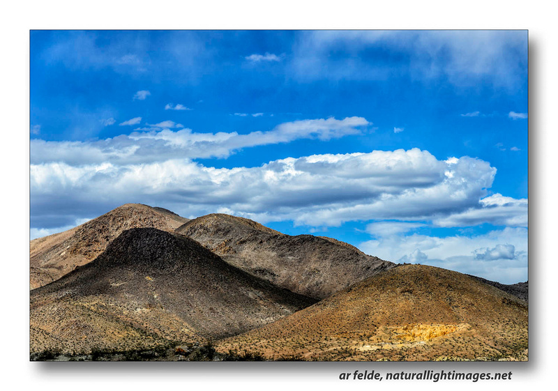
But I've gotten ahead of myself because one of the most beautiful drives in California is along Highway 395 from MoJave, CA to Mammoth Mountains. I've driven and flown it dozens of times. Its never failed to impress me! We only traveled a small portion of the distance on this trip, but it yielded some interesting images. First, four little hills along the road. I liked the arrangement, the light, and the clouds:
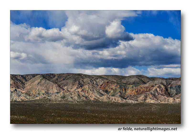
Next up was this range of hills taken about 10 miles from Mohave. At first, they appear brown and boring until your eye adjusts and you begin to see the sharpness of the angles of the ridges, and the colors from the mineral deposits:
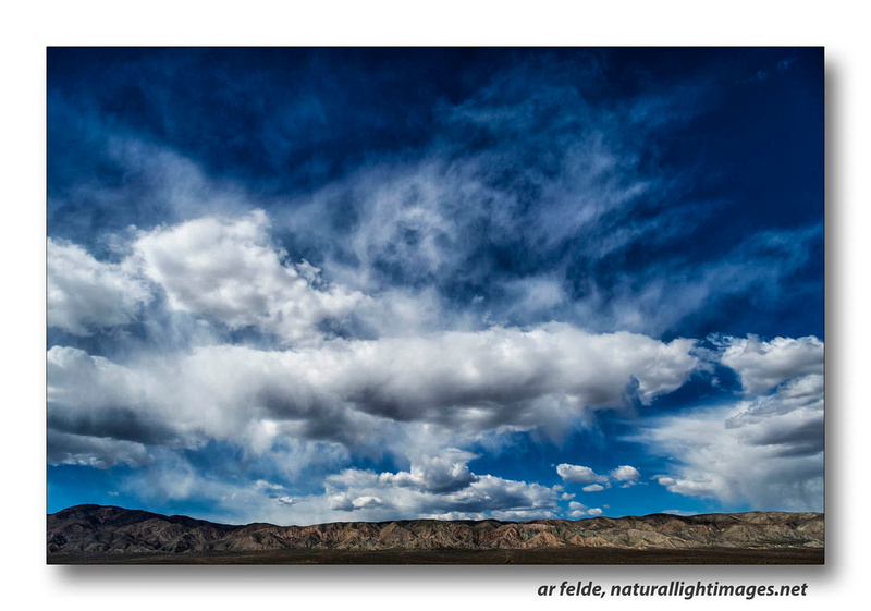
The clouds were pretty neat so I changed lenses and took this wide angle shot to emphasize them:
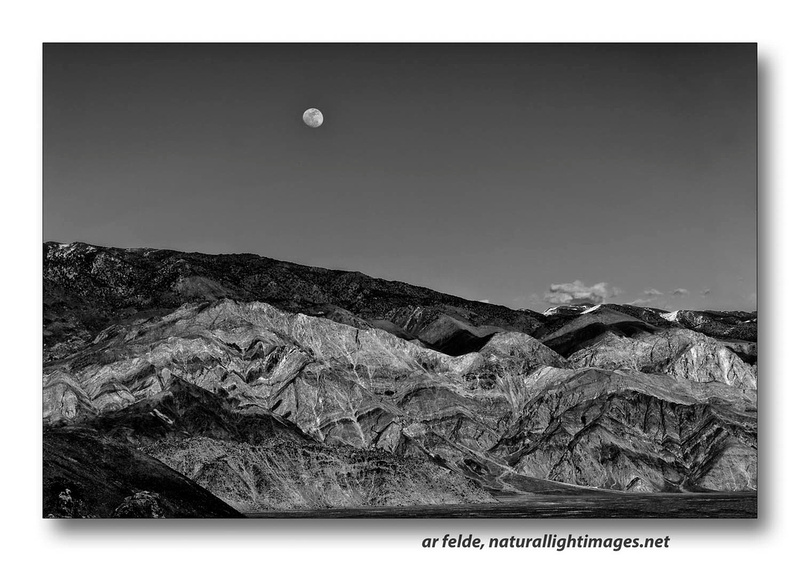
All of this from the paved highway! I'll close this posting with a last image ... taken from the Alabama Hills but not of them ... Here are the Inyo Mountains (I've always called them the White Mountains) with a nearly full-Moon rising in the East.
Next week, Rocks, and more Rocks! Bye for now, and, as always, thanks for looking!
Adam
Comments
No comments posted.
Loading...
|
Subscribe
RSS
Keywords
Archive
January
February
March
April
May
June
July
August
September
October
November
December
|